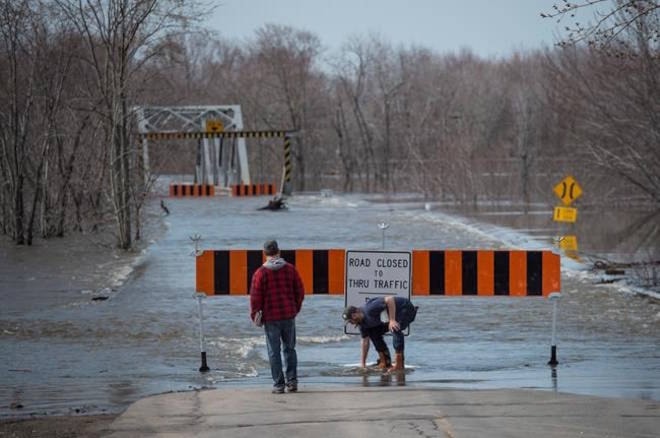
Floodwaters have surged past record levels in parts of New Brunswick, sending the flood-weary province into uncharted territory as forecasts indicate even more rain could be coming.
The Emergency Measures Organization says Saint John has hit water levels not seen since 1973 and will likely exceed that on Saturday, while Jemseg has surpassed historic records.
Spokesman Geoffrey Downey says the rising waters are closing roads and causing more people to evacuate in areas stretching from Fredericton south to Saint John, where the situation is expected to worsen in the coming days.
He says roughly 100 homes have been evacuated, affecting about 260 people, but that those numbers are expected to climb as the flooding continues.
The Transportation Department says 136 assets — including roads, bridges and ferries — have been affected by the expansive flood that has resulted in 80 complete road closures and five partial closures.
The provincial government launched the Disaster Financial Assistance program Wednesday to help businesses, municipalities and individuals who have suffered damage during the current flood.
Premier Brian Gallant said damage has already been reported and is likely to get worse in the days ahead.
Related: N.B. officials urge people to evacuate their neighbourhoods as floodwaters rise
The maximum assistance for private homes is $160,000, and $500,000 for small businesses and not-for-profit organizations. Coverage is provided to repair and clean structures and to replace basic necessities, but is not available for recreational properties.
Water levels along the Saint John River in southern New Brunswick continued to rise and emergency measures officials are urging residents in flood-prone areas to evacuate their homes.
Oromocto fire Chief Jody Price said boats are being used to rescue people from homes across the river in Maugerville, and the longer people wait to leave, the harder it is to get to them.
“The higher the water gets — and it has been a continual rise — it is more difficult for us. We went from Friday, when we could get people out of there with vehicles, to today, where we can’t go over there without a boat,” Price said.
And unless it’s an emergency, Price said people need to be moved during the daylight hours.
“We don’t send our boats and our crews in after dark for the safety of our crews. We need to move people out of there in the day time. We are urging people if you want to come out, or are thinking about coming out, then we need you to come out now,” he said.
Price said the levels of the floodwaters are the highest he has ever seen.
Further down river, people in Grand Bay-Westfield were filling sandbags and trying to protect homes Wednesday afternoon, with officials expecting a significant rise in water levels over the next few days.
Cooke Aquaculture is sending a truck loaded with 10,000 sandbags to Grand Bay-Westfield to support flood relief efforts. The company in Blacks Harbour also has boats and equipment on standby to assist, if needed.
In Saint John, the huge volumes of water in the river can only release into the Bay of Fundy at low tide, but even high tides have met their match this week against the strong currents at the city’s Reversing Falls.
Saint John resident Graeme Scott, whose home overlooks the convergence of the Saint John and Kennebecasis rivers, said he’s safe because he lives on a hill, but he’s not so sure about many of his neighbours. He said their houses are tucked into the hillside with one storey on the street and two storeys facing the water side.
“Some of their foundations are probably getting within a foot or so (of the water) and there are some people on the point that have done a bunch of sandbagging yesterday around the front of the houses,” said Scott.
“It’s right at the max of what we’ve seen before.”
Related: No way of forecasting Okanagan floods: engineer
Related: PHOTOS: Flood damage extensive in B.C. Interior
Kevin Bissett, The Canadian Press
