The future of Ponoka takes more than just an idea. Council must consider population growth, roads and perhaps more importantly how everything will be serviced.
Services such as sewer, water and roads were all discussed in a technical and detailed session with Tagish Engineering July 23. Town council listened with interest how annexed land in the Hudson Green area and the land east of Highway 2 could be serviced over the next 50 years. Wes Williams, with Tagish, outlined the Master Servicing Study and what is needed to sustain a larger population in the Town of Ponoka. “We crystal balled it.”
Although Ponoka has seen annual growth of only 0.6 per cent from 1986 to 2011, the report estimates growth is going to be closer to 1.5 per cent annually over the next 50 years with a full population of 15,000 people. The plan identifies areas needed to be serviced as the population increases:
• Water storage
Water storage on both sides of the river is going to be needed in the next six to 10 years. The estimated cost for each of the 5,000 cubic metre reservoirs is $5million. One is suggested for the Riverside area with a fire pump. “In a major fire they go in and they’re going to have to open up a valve if they needed watertransferred from Lucas (Heights) to the other side of the hill (in Riverside).”
The other reservoir will be needed along Highway 2 and Highway 53 complete with a fire pump.
• Water distribution
The system can supply fire flows but three minor upgrades are needed to ensure manual operation is not needed. In the Riverside area three pressure reducing valves on 44 and 45 Street can alleviate deficiency in flows. Those cost $450,000 each.
“Generally it’s not too bad,” said Williams.
• Water pump stations
Once a new reservoir is constructed, pumps will have to be replaced in Lucas Heights. The report states an evaluation will be needed to see how the new reservoirs function with the Red Deer regional water system.
• Sanitary sewer
Again annexed land by Highway 2 was discussed by Williams.
“How do we service to the west and how do we service the other side of (Highway 2)?” he asked.
A lift station will be needed on 39 Avenue to help flows from the west of the future 70th Street. Industrial lots west of town and near the Froman Industrial Park can be serviced by gravity feed to this proposed lift station. The station is about $500,000.
“This is not something that you have to do all at once,” he stated. “Because you’ll have time because it’ll be staged over a number of years.”
If a major company wanted to come into annexed land the town could bill them for the cost of installing these services, he said.
• Waste water treatment
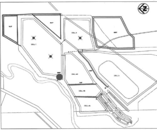
Ponoka’s waste water treatment can service a population of 10,000 and as the population increases four cell berms will need to be raised. “Storage will become a problem as the population increases.”
The report also recommends some additional upgrades to meet federal and provincial discharge requirements as the town is allowed to discharge only twice a year. Repairs in the next four years are estimated at $2.5 million with $300,000 coming from extension of the aerations system for better circulation and upgrading the outlet to the river.
• Stormwater management
The town is capable of withstanding a large storm event but should be prepared to develop proper storm ponds and outlets. Areas of consideration are the Hudson Green area, Froman Industrial Park, along Highway 2A and Highway 53 near Tim Hortons and potential flooding on 51 Street south of 49 Avenue to 46 Avenue. Also the Ponoka Golf Club, Riverside developments and Caledera areas need a stormwater outlet developed.
• Transportation plan
Ponoka has a good network to handle transportation. Along 57 Avenue will eventually become an undivided arterial road, and 57 Avenue and 53 Avenue intersections along the Highway 2A corridor will need future intersection treatment, the report stated. Dangerous goods routes will have to be updated as well. There has been some concern of dangerous goods vehicles and heavy trucks along the route on 50 Street.
Letters have been sent to trucking companies who may not know the route has been changed, explained CAO Brad Watson.
Coun. Rick Bonnett asked what route would truckers have if a new bridge replaced the North Bridge. “They are going to take the shortest route every single time.”
Williams suggests councillors will have to make the decision over what streets become dangerous goods routes.
“It might only take a few times and you’ll see some shift,” added Betty Jurykoski, planning and development officer. “I think it comes down to a matter of enforcement and signage…It is to the benefit of the downtown core.”
• Trail system
The trail system is being developed along the Battle River and will eventually become a 12-kilometre system for residents. They will be able to bike and walk along the trail system in the river valley.
Williams says the positive side of having this study is it gives developers a strong idea of what the town is going to look like. They may even want to pay for a portion of the servicing, he added.
Jurykoski sees this study as an integral part of the town’s plans and the proposed Municipal Development Plan. “The 2013 Master Servicing Study is key.”
It identifies areas in the town that will need servicing with development and population growth.