The area structure plan (ASP) for land use along the west side of Highway 2 is on its way to being a reality.
Ponoka County council heard from consultant Bob Riddett at its meeting Nov. 28. He provided an amended report regarding how the municipality should approach development of the corridor of land running from Highway 53 south to Secondary Highway 604.
That report received first reading as a bylaw at the meeting and will now go through a public hearing expected to be held in January.
As a result of what was heard at an open house on Aug. 29, as well as considering the outcomes of a traffic impact assessment, plus discussions with the Town of Ponoka, Riddett added a section to his report about storm water management.
This comes in addition with adjustments to new road infrastructure and properties designated for mixed residential and future industrial use.
“These are suggestions of what could be taken to the public hearing,” he said. “Some useful suggestions were taken from the previous meeting as well as from the traffic study and the submission from the town.”
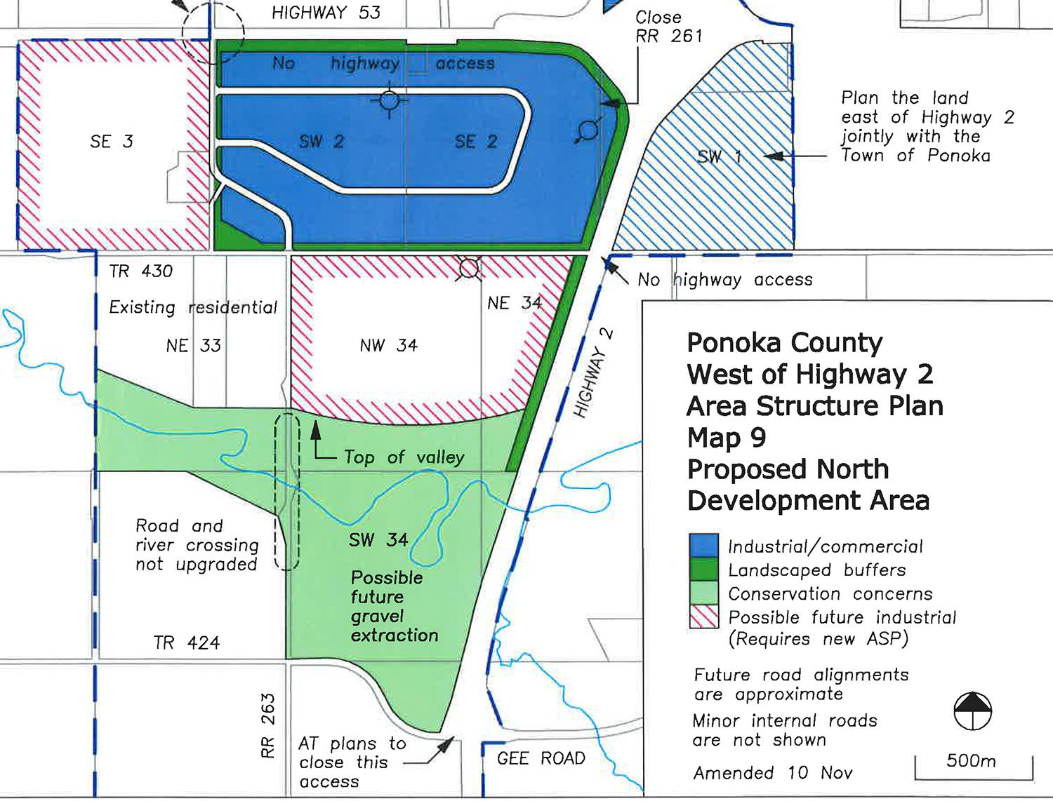
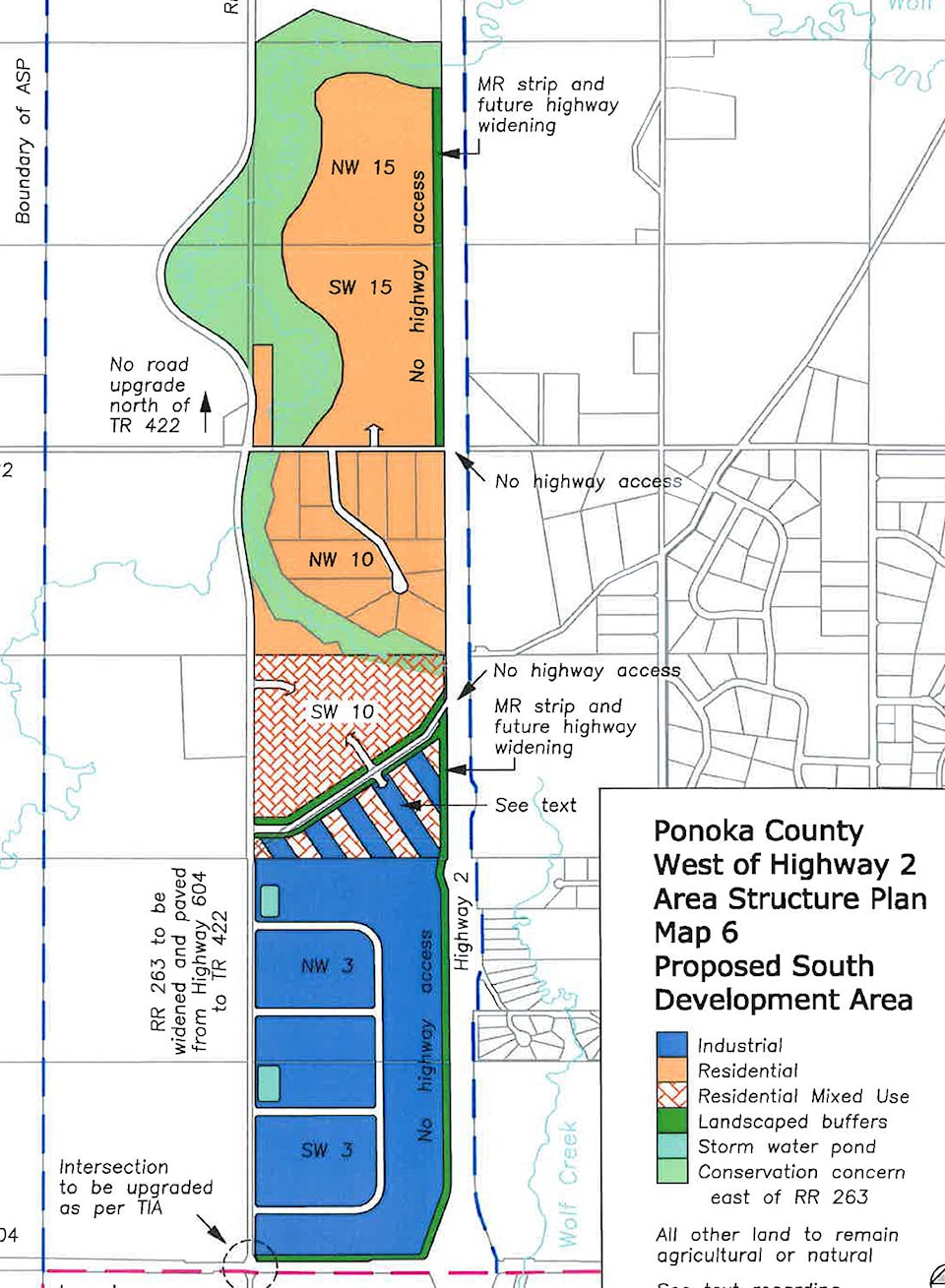
Among the land use adjustments made include making the property south of the C&E Trail — land that has been the subject of two previous rezoning attempts — be classified as either residential mixed use or industrial. It also changes the road structures on the industrial land on the south side of Highway 53.
“Due to the hilly nature of the C&E Trail area, it was thought this change would allow for better long-term use of the land and if mixed residential goes there then certainly a good buffer would be necessary between it and the future industrial area just to the south,” Riddett stated.
“The changes to an internal loop road in the industrial area south of (Highway) 53 along with changing Range Road 263 to make a better connection south and avoiding the correction line will help solve the traffic concerns.”
He added the industrial land will include a natural buffer along the outside and cut the actual size of the land from 500 to 300 acres, meaning there will be some sound protection for the current residential area nearby. Two proposed industrial parcels to the west of RR 263 and to the south of the correction line will remain, but will need a new ASP before any development would proceed.
The biggest specific change was the addition of how storm water will be managed. The new section states that any developed land — non-farm usage — that has a large hard surface area will need to install a storm water pond. That will allow runoff to be managed in a way suitable to Alberta Environment.
Also on the water front, Riddett said the town suggested it would discuss extending water lines to the industrial land west of the Highway 2 and 53. However, he did state that any major water using business would be better off being located in town given the expense of water and water treatment.
“There are advantages and disadvantages to a combined water and sewer system in this area, but it only works if development occurs quickly. If development is slow and over a length of time, then it’s a killer to spend millions on buried services only to see a couple of lots using it,” he said.