The document outlining land-use planning options along a portion of Alberta’s main traffic corridor has been approved.
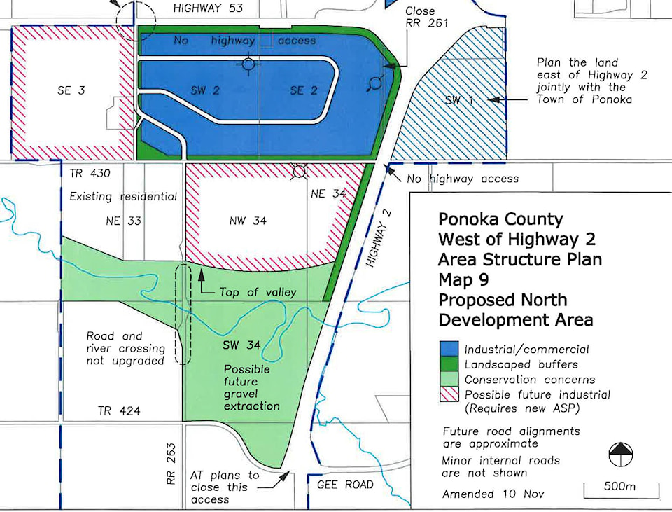
Ponoka County council made two small adjustments to the final Highway 2 Area Structure Plan (ASP) before unanimously passing the bylaw during its regular meeting on May 8.
The two changes made included making the entire portion of land on either side of C&E Trail east of Township Road 263 as residential mixed use — removing industrial from the equation — as well as cut back the size of the industrial designated land in southwest corner of Highway 2 and Highway 53 in order to create a larger buffer between the nearby residences.
Reeve Paul McLauchlin noted that because this plan is approved, the development steps must still be taken.
“This (plan) is conceptual. Council still has discretion and the development permit process must still be followed,” he said.
Now with the ASP passed, CAO Charlie Cutforth pointed out there is the question of what to do about potential road upgrades should there be a need given the opposition in the area.
He noted the county will need to proceed with caution, but Coun. Doug Weir stated things might go easier if it’s done right.
“In my mind, if we straightened (Township 263) out from the north and did a good job of it, a good job in making it aesthetically pleasing and such, maybe the residents might not have as many concerns in the future, but I think the residents will always have concerns,” he said.